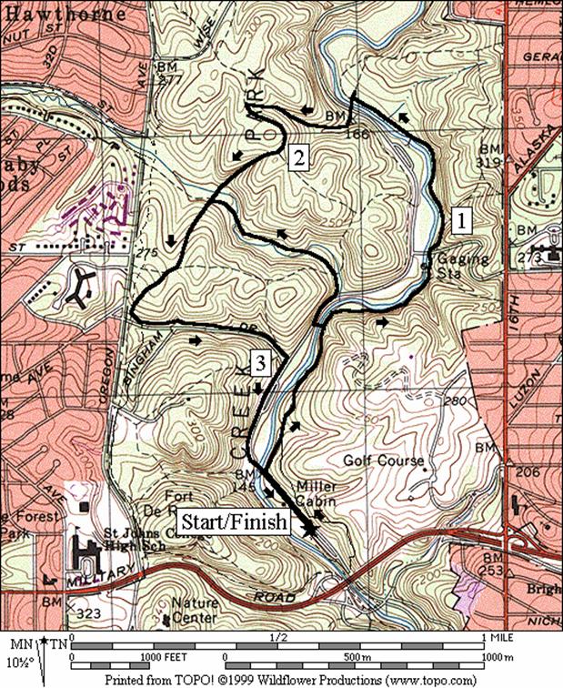
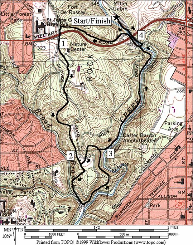
Rock Creek Park, Military Road
This
section covers the central portion of Rock
Creek National Park
and some surrounding areas. All the
separate parks listed within are maintained by the National Park Service. A surprising number and variety of unpaved
hiking trails can be found inside Washington D.C.
city limits. Some of these trails are
deep within the Rock Creek park away from sight or sound of cars and the rest
of the city. Some are along thin green
strips of land in the heart of the city.
As Rock Creek carves its way down to its mouth at the Potomac
River, steep and rocky hillsides are exposed.
Getting
There
From
the Capital Beltway (I-95), take Georgia Avenue south
for 0.5 miles. Turn right on 16th
Street.
After 2.9 miles, turn right on Joyce Rd. Bear left at the golf course and proceed to
the bottom of the hill 0.5 miles. Turn
right on Beach Drive. Turn left into the first parking lot, parking
at the far end.
Area
Routes
Northwest D.C. (14 miles, X)
Anyone
who has driven across northwest Washington, D.C.
in rush hour traffic before, can attest that it is a long trip and that it
makes you wish there was a better way.
If you’ve trained for a long run, you’ll be ready for it. This grand tour of northwest Washington,
D.C. first makes a stiff climb out of the
Rock Creek valley on a hiker-biker trail.
You continue climbing up on the sidewalks of Nebraska
Avenue. By
the time you reach the Tenleytown, you will probably be out of breath, but you
will have gotten to the high point
of the route. Your reward is a descent
of 350 vertical feet in the next 3.1 miles on the Glover Archbold Trail to the
shores of the Potomac River. Glover
Archbold Park,
like Rock Creek
Park is part of the National Park
system, and is a lesser known oasis of greenery in the city. It’s a stream valley for the Foundry
Branch. The trail is unpaved and tree
covered most of the way. There are only 4 street crossings. Most of the footing is good. A stretch of it actually is on top of sewer
pipe, but you will hardly notice and the surroundings are very pleasant. At the end of the Glover Archbold Trail,
tunnel under M Street, then take the Crescent Trail a short way to its finish
in Georgetown. Follow the shore toward Thompson
Boat Center,
then start the well graded Rock Creek hiker-biker trail gradually back
uphill. A short section of this passes
on the National Zoo grounds (gates close this segment off 5/1-9/15 6PM-8AM,
9/16-4/30 6PM-6AM; the tunnel for Beach Drive can be used when the gates are
closed but it is dangerous with room enough for the width of only one
pedestrian). At Broad Branch Rd.,
the Rock Creek hiker-biker trail ends.
The route is then on Beach Drive
back to the start. This section of Beach
drive is closed on weekends (7AM
Sat-7PM Sun & holidays). Water is available in several places in Rock
Creek Park
but nowhere along the Glover Archbold Trail.
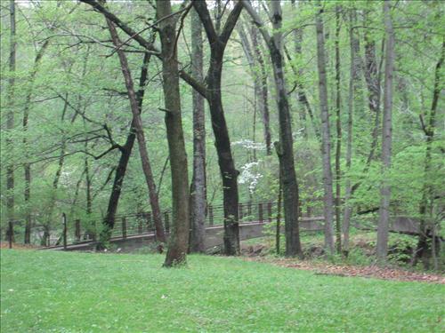
|
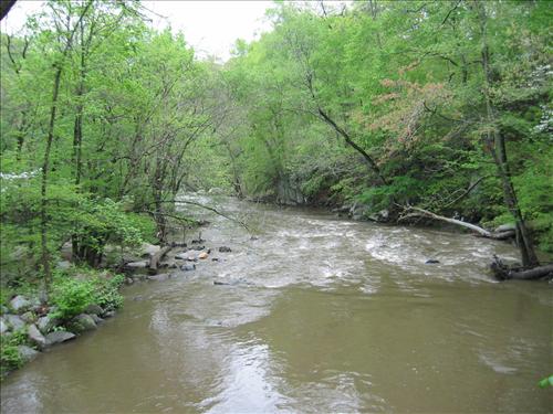
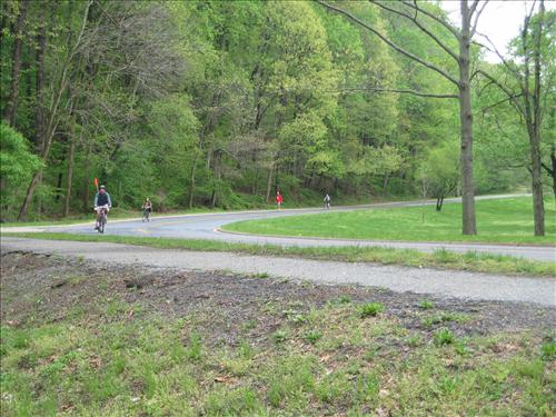
Rock Creek south of Joyce Rd.
|
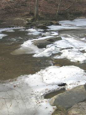
An iced over Rock Creek near Military Rd.
|
Bingham Road (3.5 or 2.4 miles,
III or II)
This
shaded loop starts with a section of the Valley Trail. The Valley Trail stays east of the Rock Creek
and is almost all dirt. Just like the
Western Ridge Trail it stretches from the north at the Boundary
Bridge on the Maryland/D.C border,
to the south at Bluff Bridge
near Piney Branch Parkway
and below. As valleys generally are, it
is easier to travel than ridges (like the Western Ridge Trail). The Valley Trail hardly ever gets very far
from the Rock Creek. Blue blazes mark
it. At the north end of the route, leave
the Valley Trail crossing from east to west over the Rock Creek and climbing up
to the Western Ridge Trail. A drop to
Pinehurst Branch, and another climb will bring you to a paved trail just before
Bingham Rd. The trail along Bingham gently puts you back
in the valley. Return along Beach
Drive to the parking area. The short route doesn’t go as far north and
bypasses one climb. In exchange, you get
an easier grade but must cross the Pinehust Branch two extra times on
stones. The crossing on stones is easily
accomplished without getting wet.
|
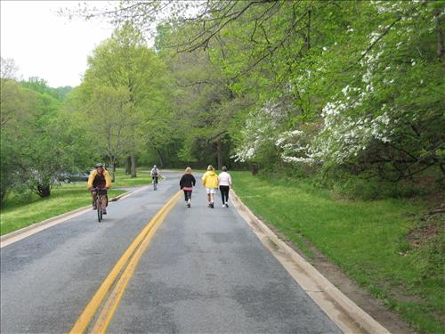
Beach Drive north of Military Rd.
|
|
Western Ridge Trail
(4.2 or 3.3 miles, V or IV)
The
Western Ridge Trail is a mix of paved and dirt paths stretching from the north
at the Boundary Bridge
on the Maryland/D.C border, to the south at Bluff
Bridge near Piney
Branch Parkway.
As ridges go they offer good views but you generally must climb up to
them from a valley. This route holds
true to that rule. A stiff climb up the
paved trail parallel to Military Road,
gets you up to the Western Ridge Trail.
After a brief dip when crossing Military Road,
the apex of the route is reached at the Nature
Center parking lot. The trip to the Nature
Center parking takes you off the
official green blazed Western Ridge Trail but is more direct and also
beneficial since water and restrooms are available for the weary. From the Nature
Center parking lot, a short section
on roads and an access trail return you to the Western Ridge Trail and its
green blazes.
The
good views are presented later on the way down to the valley and also on the
way back. The route rolls its way
downhill toward Broad Branch Rd.
and the Rock Creek. Footing on this
portion of the Western Ridge Trail is generally good but can require care when
leaves cover roots and some loose rocks.
In an open grassy area designated an Equitation Field, a coral will
appear on the left. For the short route,
turn sharply left before the coral, to a horse trail on the other side of Glover
Rd. The
short route is almost a mile shorter and avoids a second but smaller climb out
of the valley. The regular route leaves
the Western Ridge Trail just after passing the coral by first bearing right,
then bearing right 70ft. later at another trail split. It goes downhill crossing Glover
Rd. onto a paved path at the bottom of the hill,
in the valley. Continuing on the path
for just 250ft. on the paved trail, a sign for the Western Ridge Trail will
become visible on the steep hillside to your left. Pass it but turn left immediately afterward
onto the grass, at first staying in the valley parallel to Beach
Drive.
Return instead on a horse trail, the head of which is marked by two
white posts at the far edge of the grass field.
The horse trail is wide. It
climbs one significant hill skipped by the short route, onto the ridge again
where good views of the valley below are to be had. The short route eventually merges and you
descend to the valley again. The horse
trail in the valley is soft, fairly flat, shady and pleasant as it follows the
grade of the Rock Creek upstream back to Joyce and Military Roads.
Northwest D.C.
Distance: 14.0 miles
Rating: X; Early hills; sidewalks, unpaved
blazed trails, hiker-biker trails, roads
L 0.0 on
paved trail (head south) from the north end of the parking lot at Picnic Area 6
R 0.25 at
Joyce Rd; continue on paved
trail
L 0.95 at
T before Oregon Ave
CR 1.0 Military Rd.
L 1.7 Nebraska Ave
2.1 Connecticut Ave
S 2.9 clockwise
through Tenley Circle; Wisconsin
Ave
L 3.05 41st St
CL 3.15 Van Ness St
R 3.25 Glover
Archbold Trail; at the bottom of the hill; follow blue blazes
BR 3.85 at
open field before road
3.95 Massachusetts
Ave (down stairs after crossing; follow blue blazes)
L/R 4.35 Cathedral
Ave (unmarked)
L/R 4.55 New
Mexico Ave (unmarked)
4.9 Wesley
Heights Trail on R
5.4 Whitehaven
Trail on L
R 5.6 over
stream (Foundary Branch) to stay on Glover Archbold trail (follow blue blazes)
L/R 5.7 cross
Resevoir Rd at 44th St;
R downhill into & across open field
L/R 6.25 down
stairs before MacArthur Blvd
to old underpass (! 6.5' head clearance)
L 6.35 Crescent
Trail (paved)
S 6.7 trail
ends; continue on Water St
BR 7.2 at Wisc
Ave on L; Harbour Parking on R; through park to
wooden dock
L 7.45 before
Thompson Boathouse
L 7.55 Rock
Creek Trail
7.65 underpass
for Whitehurst Freeway
7.75 C&O Canal Towpath/Penn Ave
8.65 Devils
Chair Bridge
9.4 Shoreham
Hill Bridge & Parkway Trail on L
9.6 Connecticut
Ave ramp X
L 9.85 through
gate into Zoo grounds before tunnel; open (5/1-9/15
6AM-8PM); (9/16-4/30 6AM-6PM);
closed 12/25
11.2 underpass
for Porter St
11.8 underpass
for Tilden St
BR 12.15 onto
Beach Dr after crossing Broad
Branch Rd
12.65 Boulder
Bridge
13.75 Joyce Rd
L 14.0 2nd
entrance for Picnic Area 6 parking
Bingham
Drive
Distance: 3.5 or 2.4 miles
Rating: III or II
3.5
Mile Route
L 0.0 on
Beach Dr (head north) from
the north end of parking at Picnic Area 6
R 0.15 on
unpaved trail going upstream before bridge over Rock Creek
BL 0.3 Valley
Trail (blue blazed, unpaved)
<*
BL 0.9 trail
X; to Sherrill Dr underpass
after Whittier Trail on R
BL 0.95 trail
X; to stay on Valley Trail
1.0 Holly
Trail on R
L 1.45 leave
Valley Trail to Riley Spring
Bridge at trail X (sign shows 1.6
miles to Military Rd & 1.4 miles to Boundary
Bridge)
1.5 Beach Drive
BR 1.55 cross
Beach Dr; follow trail into woods and up the hill
L 1.8 Western
Ridge Trail (green blazed)
2.2 Pinehurst
Trail X after crossing creek
>*
R 2.4 at
T to stay on Western Ridge Trial; follow green blazes
L 2.55 on
paved hiker-biker trail and L again at X before Bingham
Dr ; downhill along Bingham
Dr
R 3.0 to
stay on trail before Beach Dr
3.5 parking
at Picnic Area 6

L 0.55 toward
Rolling Meadow Bridge
R 0.6 Beach Dr
L 0.7 Pinehurst
Trail at bridge and Xwalk
0.85 cross
Pinehurst Branch on stones
1.1 cross
Pinehurst Branch on stones
L 1.15 Western
Ridge Trail (green blazed, pickup cues at mile 2.4 on 3.5 mile route)
Western Ridge Trail
Distance: 4.2 or 3.3 miles
Rating: V or IV; paved and unpaved trails;
shady with excellent views
4.2
Mile Route
L 0.0 on
the paved trail (head south) from north end of parking at Picnic Area 6
R 0.25 at
Joyce Rd; continue on paved
trail
L 0.95 at
T before Oregon Ave
1.0 Military Rd;
continue paved trail
BR 1.15 through
Nature Center
parking lot (water, bathrooms in the center on L)
R/L 1.2 to
leave parking lot; onto Nature Center & Maintenance access road
BL 1.4 Glover Rd
BR 1.45 unpaved
horse trail to Western Ridge Trail
L/R 1.5 Western
Ridge Trail (green blazes)
<*
R 2.1 3
way split after Equitation Field; leave Western Ridge Trail; downhill
S 2.35 cross
Broad Branch Rd; paved
trail
L 2.4 on
grass after passing Western Ridge Trail (sign) on L; toward white posts
S 2.45 white
posts mark horse trail at woods
2.7 trail
X; R is toward Boulder Bridge
BR 2.95 trail
X to the valley
>*
3.25 trail
X on L
3.3 Rapids
Bridge on R to Beach
Dr
CR 3.9 Joyce Rd; onto
the hiker-biker trail
L 3.95 to
stay on trail at Beach Dr
4.2 north
end of the parking lot
L 2.1 on
grass immediately before Equitation Field & coral
2.15 cross
Glover Rd; horse trail head
near large stone marker; downhill
L 2.3 horse
trail X (pickup cues at mile 3.25 on 4.2 mile route)