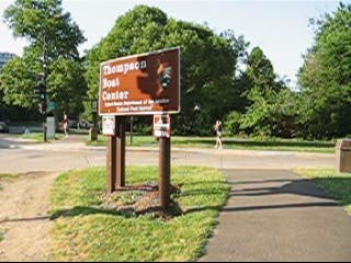
Rock Creek Park, Thompson Boat Center
The Thompson Boat Center in Rock Creek National Park. It’s right on the
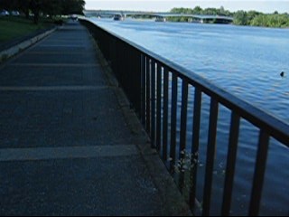
paved Rock Creek hiker-biker trail but also close to five other major trails
which are outside the park. By foot, you
can reach the: Chesapeake and Ohio (C&O) Canal Towpath, Capital Crescent
Trail, Glover Archbold Trail, Custis Trail, and the
Mount Vernon Trail. In addition, it’s
within easy reach of The Mall. Boats and
bicycles can be rented at the boathouse.
Some local high school and university crew teams base their training at
the boathouse. Parking, just off Rock
Creek Parkway across from the infamous Watergate
complex, is limited so arrive early.
Getting
There
From
Montgomery County, Maryland
(except evening weekdays)
Exit
the Capital Beltway (I-95), at the River Road
(Rte. 190) and Cabin John Parkway
exit, onto the Cabin John Parkway. The Cabin John
Parkway merges onto the southbound Clara
Barton Parkway after 1.3 miles.
At the Chain Bridge intersection, 3.3 miles later, the road changes its
name to Canal Road. This intersection also is as far as you can
go southbound during evening rush hour, because during that time, traffic is
one way northbound, leaving D.C. (cut through the city or see directions from northern Fairfax
County below to get there during
evening rush hour). Continuing on, bear
right after 2.6 miles onto M Street, taking care not to stay in the
right turn only lane for the Whitehurst Freeway. After 0.9 miles, turn right onto Wisconsin
Avenue.
Turn left at the bottom of the hill onto Water
Street (under the Whitehurst Freeway). Bear right at the end of Water
Street onto the Rock
Creek Parkway, then turn
right at the traffic light into the Boat
Center parking.
From
Northern Fairfax County, Virginia
Exit
the Capital Beltway onto the George Washington Parkway. Go southbound for 8.5 miles to Francis
Scott Key Bridge. After crossing the bridge into Georgetown,
turn right on M Street. One third of a mile later, turn right on Wisconsin
Avenue.
Turn left at the bottom of the hill onto Water
Street (under the Whitehurst Freeway). Bear right at the end of Water
Street onto the Rock
Creek Parkway, then turn
right at the traffic light into the Boat
Center parking.
From
Southern Fairfax County, Virginia
Exit
the Capitol Beltway, I-95, northbound onto Henry G.
Shirley Highway (I-395). After approximately 9.5 miles, take the left
exit just before the 14th Street
Bridges, northbound onto the George Washington Parkway. Stay in the left lanes and follow the signs
to Arlington Memorial
Bridge. After crossing Memorial bridge, bear right on
the clover leaf ramp to Rock Creek Potomac Parkway. Stay in the left most lanes through several
twisting and branching intersections.
After 1 mile, passing under the Kennedy
Center and then passing the
Watergate on the right, turn left into the Boat
Center parking lot.
From
Prince Georges
County, Maryland
Use
the Capital Beltway (I-95), to get to Rte. 50 west or I‑295 north. From either, take the westbound Southeast
Freeway (I-395) after 11 miles or approximately 6 miles respectively. After 0.9 or 2.75 on the Southeast Freeway respectively,
bear right onto Main Avenue. Main Avenue
merges onto Independence Avenue
at the Tidal Basin. Just before the underpass for Memorial
Bridge, Independence
Avenue becomes the Rock
Creek Potomac Parkway; this is 1.4 miles after the
exit from I-395. Once on the Rock
Creek Potomac Parkway. Stay in the left most lanes through several
twisting and branching intersections.
Follow the Rock Creek Parkway 1.1 miles, You will pass under the Kennedy
Center and then the Watergate
complex on the right. Turn left into the
Thompson Boat
Center parking lot.
By
Metro Rail
Ride
metro rail’s Blue or Orange lines
to Foggy Bottom station then walk or run around Washington
Circle onto Pennsylvania
Avenue, heading toward Georgetown. After crossing on the bridge over the Rock
Creek Parkway, turn left on the connecting asphalt
path to the Rock Creek Trail. Turn right
on the trail to the Thompson Boat
Center parking. The total distance from the station is 0.8
miles.
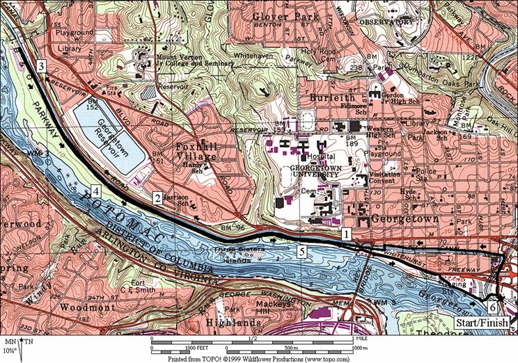
Area
Routes
Georgetown Loop (5.45
miles, IV)
From
the intersection of the Thompson Boat Center parking entrance and the Rock
Creek Trail, take the paved Rock Creek Trail northward, under the Whitehurst
Freeway. After only 0.2 miles a red
brick trail on the left marks the beginning of the C&O Canal Towpath. The towpath continues 184.5 miles west to Cumberland,
MD.
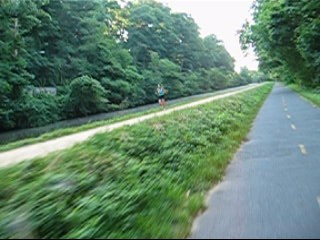
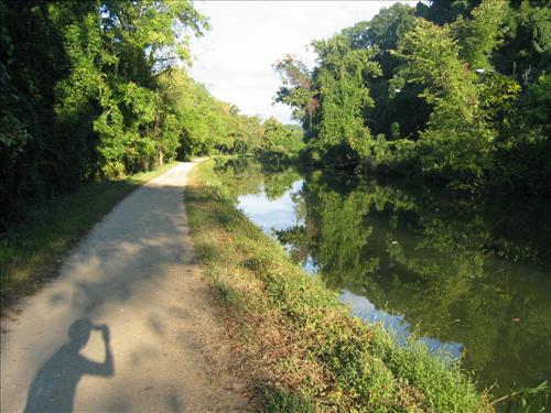
Continuing past the towpath, the Rock Creek Trail is initially somewhat
narrow and close to the busy Rock Creek Parkway. Daffodils bloom abundantly in early spring on
the grassy and sunny hillsides. The
trail widens after the P Street
underpass. The Devils Chair bridge near Oak
Hill Cemetery
brings the trail to the east (right) bank of the Rock Creek. The rocky and hilly cemetery is both gothic and
beautiful. Many of the cities arteries
pass over the Rock Creek valley. Look
for the detail on the Q Street
bridge which has casts of American Indian faces on it. Others like the Massachusetts
Avenue bridge are arched in a manner common to
many of Washington’s older
structures. Watch the other bank on the
left side of the Rock Creek for part of the return loop. At the Shoreham
Hill Bridge,
0.8 miles after the Devils Chair
Bridge, the trail crosses the Rock
Creek again. Immediately after the
bridge, on the left is the turnaround/trail head for the Parkway Trail. It’s unpaved but wide with good footing (see
the description for Dumbarton Oaks loop in the Rock
Creek Park,
Pierce Mill section of this guide).
Partway
up the hill at the end of the Parkway Trail, is Lover’s Lane. The once cobblestone street is now asphalt on
one end and dirt on the other. It
connects Massachusetts Avenue
with R Street and is closed
to traffic. It’s also off-limits to
people, even lovers, at dark. Turn left
up Lover’s Lane 0.15 miles to R Street. The way through Georgetown
town is on sidewalks and known as the Montrose Connector (it connects Montrose
Park and Glover
Archbold Park). It passes houses more typical of an earlier Washington
D.C.
Pass Dumbarton Oaks mansion, the Duke
Ellington School
of the Arts, Georgetown University
and the Embassy of France along the connector.
The tree covered and dirt Glover Archbold
Trail descends to the Crescent Trail.
Follow the Crescent Trail along the Potomac River
to its end at Water Street;
under the Whitehurst Freeway. Continue
on Water St. until you can
bear right at the Wisconsin Avenue
intersection to Washington Harbor. Follow along the river on the boardwalk back
to Thompson Boat
Center.
|
|
|
|
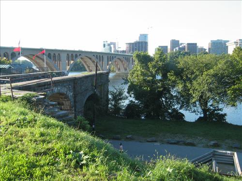
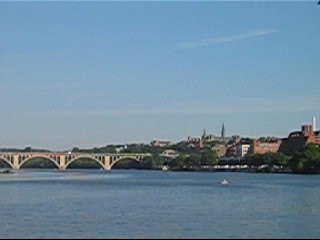
Old
to New. From the C&O Canal Towpath
can be seen the remains of the old aqueduct bridge, Key
Bridge and a growing Rosslyn, Virginia.
|
Approaching
the downtown Georgetown area on
the C&O Canal Towpath.
|
Fletchers Boathouse (6.05 or
2.6 miles, IV or II) Video
From
the intersection of the Thompson Boat Center parking entrance and the Rock
Creek Trail, take the paved Rock Creek Trail northward, under the Whitehurst
Freeway. Quickly turn left after the
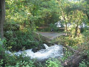
freeway underpass onto the red brick C&O Canal Towpath. Follow up the C&O Canal Towpath past
locks 1 through 4. The locks and canal
are well maintained and for much of the year, mule drawn boat rides are
available. After the locks, the trail is
virtually level. If you have time, stop
in at the C&O Canal
Visitor Center,
located on the towpath just after 30th
Street. The
brick surface ends soon after the Visitor
Center and is replaced by crushed
gravel and dirt. Continue on the north
(right) side of the canal until just before the massive Key
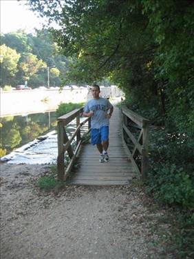
Bridge underpass. There, take the footbridge to cross to the
other side of the canal. As you pass
under Key Bridge,
views of the river open up. The stone
remains of the old aqueduct/canal that once carried water from Arlington
into Georgetown are visible
here. Also from here, the towpath begins
to closely parallel the Capital Crescent Trail.
Only a few trees and the higher
elevation of the towpath separate the two trails. After a half mile, a ramp and stairs on the
left mark the intersection of the Glover Archbold
Trail, return point to the Capital Crescent Trail for the short loop. Continuing on, the towpath and the Crescent
Trail get even closer together so that only a narrow grass strip and a vertical
foot separate them. Finally, make a left
hand U-turn at the foot bridge on the right that takes people from Abner Cloud House and Canal Rd.
over the canal to Fletcher’s Boathouse (the boathouse is on the left side,
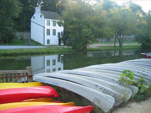
nearer the river). The park at
Fletcher’s Boathouse has water, restrooms, a snack bar, picnic areas and canoe
rentals. It is also a training center
for local rowing teams.
The
return trip is on the paved Capital Crescent Trail. This trail is more preferred by cyclist and
in-line skaters. The skaters in
particular, favor the trail for its wide, flat and smooth, surface. Nice views of the Potomac River
are to be seen. In the spring, wild
Wisteria vines bloom on tall trees over the water. In the summertime, kayakers paddle around the
Three Sisters
Island rocks and boaters sunbath on
their decks. After the trail ends, follow Water Street
under the Whitehurst Freeway to Washington
Harbor and Thompson
Boat Center,
like the Georgetown Loop described above does.
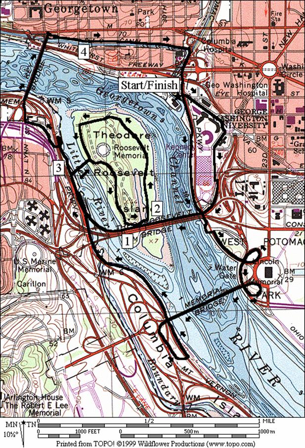
Theodore Roosevelt Island
From Washington (4.7, 6.3, or 3.15 miles, IV, V, or III)
Tour
pieces of history and enjoy commanding views over the Potomac River
on this short loop within a loop. For
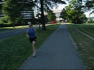
the regular route, leave Thompson Boat
Center on Virginia
Ave., heading east. Check your stride in reflection in the
windows of the posh shops on the ground floors of the infamous Watergate
buildings. Later, cross in front of the J.F.
Kennedy Center
for the Performing Arts. A trail along
the freeway takes you up onto the Theodore
Roosevelt Memorial
Bridge which crosses into Virginia. The trail on the bridge is a little narrow
but is pretty well guarded from the road (I-66). It drops down to join the Mt. Vernon
Trail before arriving at the parking lot for Theodore Roosevelt Island.
The
longer option starts at the boathouse parking but follows the Potomac
River downstream. On the
way it passes the J.F. Kennedy
Center for the Performing Arts and
the Lincoln Memorial. Following the
trail along the looping exit ramps, it avoids the worst intersections before
crossing onto Columbia Island
on Memorial Bridge. There are two busy intersections to cross
before joining the Mt. Vernon Trail. The
Mt. Vernon Trail links the longer option to Theodore Roosevelt Island
parking.
From
the parking lot, take the bridge across Little River (a fork of the Potomac)
to the island. On the island are
interpretive exhibits, the memorial to the President, and crushed gravel
trails. Theodore Roosevelt believed in
the need for wild places to challenge the soul and actively applied this policy
himself. The island was once cleared of
trees and farmed in the 1800's. In a
fitting tribute, it is now wooded in the midst of city all around it. Park placards say it’s now close to the way
Captain John Smith saw it 400 years ago.
To loop the island (it’s 1.36 miles around by trail), one must use the
Wood Trail, then the Swamp Trail to cross a wetland. Most of the way on along the Swamp Trail is
on a boardwalk 2000ft. long. Though made
of recycled plastic, it’s a nice improvement from the muddy mess that the old
trail used to be. In May in the wetland,
see wild yellow irises and Red-Winged Blackbirds.
After
the island (the shortest route skips the island completely), the paved
Mt. Vernon trail crosses over the George Washington Parkway on a bridge
before ending at Key Bridge. After
crossing Key Bridge
over the Potomac into Georgetown,
turn right, down to the C&O Canal. Finish by using the Rock Creek Trail to
return to Thompson’s Boat Center.
|
|
|
|
|
Top
Left – Watergate & the Kennedy Center
Left
– Rock Creek Trail along the Kennedy
Center
Above
– Key Bridge
& Georgetown
|
Nearby
and Connecting Zones
Food
and Drink
Viet
Georgetown - Vietnamese food at great value - (202) 337‑4536
Sala Thai; Thai cuisine - (202) 872‑1144
The
Burro; quick Mexican food
-
202
483-6861
Café
Luna - pasta and pizza - (202) 387‑4005
Teaism - tea, dessert, and meals -
202
667-3827, 202 835-2233
Fuzio - pasta - 202 986-5300
The
Tombs - sandwiches and dinners near Georgetown
University -
(202)
337‑6668
Entertainment
and Edification
Old
Stone House; oldest standing building in Washington
(1765); (9AM-5PM Wed-Sun); (202)
426-6851
Dumbarton
House - garden and mansion - (202) 337‑2288
Lincoln
Memorial - 202 426-6895
Vietnam
Veteran Memorial - 202 634-1568
Kennedy
Center for the Performing Arts -
(202) 467‑4600
Ford’s
Theatre - 202 426-5924
Georgetown Loop
Distance: 5.45 miles
Rating: IV; paved hiker-biker trails;
unpaved trails, city sidewalks
L 0.0 from
the parking lot on the Rock Creek Trail
0.1 underpass Whitehurst Freeway
0.2 C&O
Canal Towpath on L
1.1 Devils
Chair Bridge
crosses Rock Creek
L 1.85 immediately
after Shoreham Hill
Bridge crosses Rock Creek
L 2.5 Lover’s
Lane (unmarked); just before Dumbarton Oaks Trail
R 2.65 R St
L 3.3 38th St
at T
CR 3.35 Reservoir Rd at T
BL 3.65 onto
grassy trail/field; down into Glover Archbold Park
BL 3.75 Glover
Archbold Trail (blue blazed)
L/R 4.15 after
trestle bridge underpass; down the stairs before MacArthur Blvd to the old
tunnel (6.5' head clearance) to stay on trail
L 4.25 Crescent
Trail
S 4.6 trail
ends; continue on Water St
BR 5.1 at
Wisconsin Ave X on L; Harbor Parking on R; through park to wooden dock at river
L 5.35 before
Thompson Boat
Center; bridge crosses Rock Creek
5.45 Rock
Creek Trail & parking
Fletcher’s Boathouse
Distance: 6.05 or 2.6 miles
Rating: IV or II; paved trails and gravel
towpath; shady with excellent views
6.05
Mile Route
L 0.0 from
the parking lot on the Rock Creek Trail
0.1 underpass Whitehurst Freeway
L 0.2 C&O
Canal Towpath on L
0.4 C&O
Canal Visitor Center (water, restrooms)
L/R 0.65 cross
canal on bridge at T
<*
1.9 C&O
towpath mile marker 2
UL 3.1 onto
Capital Crescent Trail at ramp nearest Fletcher’s Boathouse (water, food,
restrooms)
3.45 Crescent
Trail mile marker 8.5
3.95 Crescent
Trail mile marker 9
4.85 Glover
Archbold Trail on L (see tunnel)
>*
S 5.2 trail
ends; continue on Water St
BR 5.7 at
Wisconsin Ave X on L; Harbor Parking on R; through the park to the wooden dock
L 5.95 before
Thompson Boat
Center; cross Rock Creek
6.05 Rock
Creek Trail & parking

*2.6
Mile Route
L 1.4 ramp
and stairs down to Glover Archbold Trail
L 1.4 sharp
left onto Capital Crescent Trail (pickup cues at mile 5.2 on 6.05 mile route)
4.7 and 3.15 Mile Route
<*
0.0 from parking cross the Rock Creek Parkway at the light onto Virginia Ave
BR 0.2 traffic circle
CR 0.25 New
Hampshire Ave
0.35 F Street (go S up hill toward the Kennedy Center for the Performing Arts)
BL 0.5 trail X on L (after Kennedy Center on R;
the trail crosses the hwy exit ramp for entrance to parking then goes to
Roosevelt Bridge)
1.3 Mt Vernon Trail merges from R
>*, <**
R 1.4 bridge to Roosevelt Island (parking)
R 1.5 at T after crossing bridge
L/R 1.55 L at trail X on R; R at memorial on L
1.75 trail X on R (unmarked)
1.85 Upland Trail on L (water/restroom)
1.9 bridge underpass and trail X on R; plastic
boardwalk ahead is Swamp Trail
2.1 trail X on L to Lookout Pt
BL 2.5 at trail X on R to river; Upland Trail on L
just ahead
L 2.65 trail X before river
R 2.85 to bridge into Virginia
R 2.95 Mt. Vernon Trail (parking)
>**
3.15 Heritage Trail on R before ramp/bridge over GW Pkwy
R 3.35 Lynn St; to Key Bridge into Georgetown, DC (Custis Trail is S)
R 3.8 trail X on R after Key Bridge
R/L 3.85 down stairs to ramp & canal; do not cross
the canal; L on towpath
4.3 Visitor Center on L (water/restroom)
R 4.45 Rock Creek Trail at T
R 4.7 Thompson Boat Center parking

*6.3 Mile Route
R 0.0 trail X on R along river toward Kennedy Center for the Performing Arts
0.6 Rte 50/I-66 underpass
XS 0.65 at NW Parkway X; continue S toward Lincoln
Memorial
L 0.9 Lincoln Circle; continue bearing L
following trail down clover ramp
1.05 underpass NW Parkway
1.15 underpass Memorial Bridge; follow clover ramp up to Lincoln Circle
L 1.25 Lincoln
Circle
L 1.35 Memorial Bridge
1.8 trail X on R from Arl Cemetery; dangerous exit ramp X ahead (!)
BL 1.9 trail X; R is toward Pentagon
CL 2.0 cross GW Pkwy (!)
onto Mt Vernon Trail
2.2 underpass Memorial Bridge (! narrow)
2.6 bridge over Boundary Channel
2.7 underpass Rte. 50
BR 2.95 at trail X (pickup cues at mile 1.4 on 4.7
mile route)