Fran Uhler Natural Area/Race Track Spur
There
are plenty of county and city parks in within Bowie,
Maryland.
The Fran Uhler Natural Area is one of the most recently acquired and it
keeps growing. The area preserves
wetlands along the Patuxent River
and is an old destination for bird-watchers and fishers. A nature trail through it wanders beside the
river banks and the surrounding feeder streams.
Except for the nature trail, bicycles are allowed on the trails
in the area. The routes only start in the
Fran Uhler Natural Area before going into Uhler
Park and Lakes that is located
north of Bowie State
University. From Uhler
Park and Lakes, you can follow the
Race Track Spur railroad grade to the Washington, Baltimore & Annapolis
Trail (WB&A). The WB&A, also on
an abandoned railway, is a paved 5.6 mile long trail through Prince
Georges County
from Lanham to Bowie. It was just completed in November 2000. Anne Arundel County also has begun to extend
the WB&A trail from Bowie toward Annapolis where it may one-day connect to
the Baltimore and Annapolis Trail however there is no bridge over the Patuxent
River yet. The abandoned WB&A
Railroad started operation in 1903 and transported passengers between
Washington and Baltimore for 32 years.
Both Fran Uhler
Park and Lakes and Patuxent
River Park
are used for orienteering meets put on by the Quantico Orienteering Club. Be aware that beavers constantly change the
landscape often flooding trails in wet seasons.
Getting
There
From
the Capital Beltway (I-495), take Rte. 450 north. Stay to the right after the first light (it=s within a quarter mile of the beltway)
and turn right at the next onto Lanham Severn Road
(Rte. 564). Just over five miles
after getting on Lanham Severn Road, after the bridge over the railroad, follow
the right-of-way though a left turn onto 11th Street in old
Bowie. About a mile later, turn left at
the stop light onto Laurel Bowie Rd.
(Rte. 197). Pass the next traffic light,
and turn right after the bridge over the railroad onto Lemons
Bridge Rd.
Follow this nearly one mile to the gate at Fran Uhler Natural Area and
park on the left.
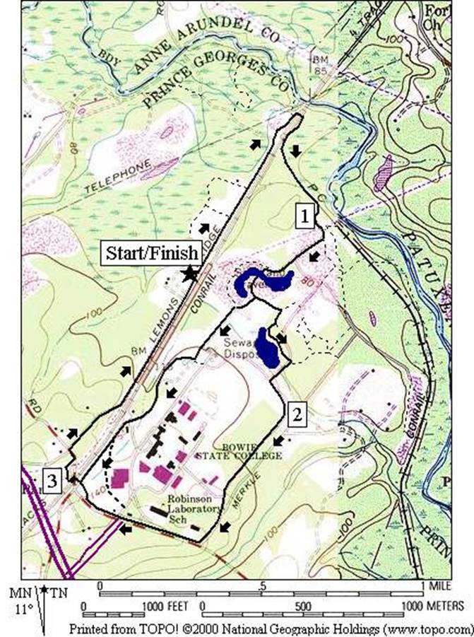
Area
Routes
Fran Uhler Lakes and Park (3.85
or 3.05 miles, III or II)
This
route starts along Lemon=s
Bridge Rd. and parallels
the active railroad. It is somewhat
paved at first but not for long. After
passing the signed nature trail on the left, the trail makes a U-turn to the
right to cross under the tracks at a bridge near the Patuxent
River. Don=t
be tempted to cross the tracks early. The commuter trains pass quietly and quickly
along this stretch. As the route leaves
the active tracks, it follows the bed of the old Race Track Spur line. The abandoned rail spur, used to transport
passengers from far and wide to the now defunct Bowie Race Track. As of 1999, the spur is surfaced with rough
gravel and dirt. The route leaves the
spur as it passes under high tension power lines, and passes by a moat-like
pond and nature demonstration area (pictured below). The area around the pond appears to be
recovering from years when it was used for sand and gravel operations. Many gravel and dirt roads loop and intersect
near here. Stick to the route so as not
to get lost. The short route option
however breaks-off near the pond to go to the commuter rail station and the
turn for it is easily identified by being one of the few right turns on
route. Skipping that, continue around
the pond to reach short paved trails which take you to the north end of Bowie
State University
campus. Go around the university on sidewalks, and for a short stretch on the shoulder of Jericho
Park Rd. near the main entrance of the
university. Avoid traffic on the Laurel
Bowie Road by crossing back under the railroad
tracks through the Bowie Rail Station.
Lemon=s Bridge
Rd. after that is quiet and down-sloping but watch
out so as not to be on the inside at the one blind curve. The few cars that do drive the road tend to
come around fast.
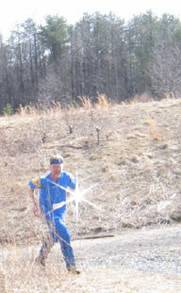
Greg Lennon Orienteering in Fran Uhler.
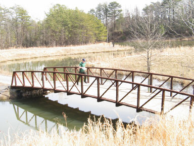
A lake in Fran Uhler.
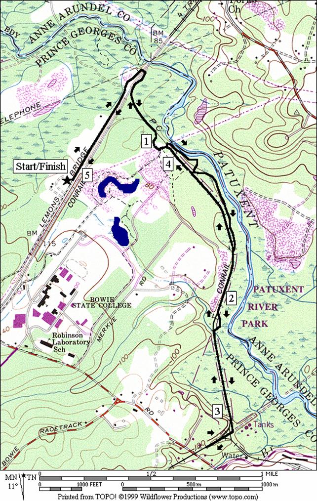
Race Track Spur (5.05 miles, IV)
The
first mile of this mostly out and back route starts the same as the Fran
Uhler Lakes
and Park route. It breaks off while
under high tension power lines. A
winding unpaved trail kept-up by off road recreation vehicles skirts the banks
of the Patuxent River. One spot a quarter mile past the power lines
is particularly scenic. You might see a
Great Blue Heron fishing the swift and healthy looking waters. This trail eventually returns to the railroad
grade for the out and back portion of the route to the Washington Suburban
Sanitary Commission plant and the WB&A Trail. The trail on the spur is not yet maintained. Running shoes and bicycle tires tend to sink
in the loose gravel making it tough to run or ride through. Most of the old railroad ties have been
removed but some remain.
Nearby
and Connecting Zones
Washington, Baltimore & Annapolis Trail, Glenn Dale
Foxhill Park, Bowie, Maryland
Patuxent Research Refuge North Tract
Beltsville Agricultural Research Center
What
to do Afterward
Food
and Drink
Outback
Steakhouse (301) 464‑5800
La
Hacienda (301) 262-8800
Entertainment
and Edification
Marietta
Mansion - plantation home of
Supreme Court Associate Justice Gabriel Duval, 1752‑1844 -
(301) 464-5291; TDD 277-8456
Railroad
Museum - 301 809-3089
Fran
Uhler Lakes and Park
Distance: 3.85 or 3.05 miles
Rating: III or II; gravel and dirt roads,
some sidewalks & paved road, mostly flat
3.85
Mile Route
L 0.0 Lemon=s Bridge Rd
from parking
0.25 trail
X on L
0.3 trail
X on L
0.5 road
X on L
0.55 Nature
Trail on L
0.6 railroad
underpass
BR 1.05 Rd X
under power lines
L 1.3 trail
X on L goes to wooden bridge over moat-like pond
1.4 trail
X on R
<*
R 1.6 paved
trail X on R
BR 1.65 paved
trail X on R
R 1.8 trail
ends at T w/unpaved road
CL 1.9 Loop Rd; Bowie
State University
R 2.5 at
T onto Jericho Rd (!
unmarked, use shoulder)
2.7 Bowie
State University
entrance; go straight toward train station and commuter lot
BL 2.95 Tunnel
to Southbound Trains, in tunnel turn R twice
>*
R 3.05 R
at tunnel exit; through parking lot
toward parking lot exit
R 3.15 Lemon=s Bridge Rd
L 3.85 gate
in road just past parking

*3.05
Mile Route
R 1.4 Rd
X on R
BL 1.5 through
gate at Rd X on R
R 1.7 Rd
X at T; L is toward track and parking; Bowie
State University
BR 2.2 through
commuter trail parking lot as road bends left
R 2.3 Tunnel
to Southbound Trains, in tunnel turn R twice (pickup cues at mile 3.05 on 3.85
mile route; end is 3.05 miles)
Race Track Spur
Distance: 5.05 miles
Rating: IV; gravel and dirt roads, dirt
trails and loose gravel railroad grade
L 0.0 Lemon=s Bridge Rd
from parking
0.55 Nature Trail on L
0.6 railroad
underpass
L 1.05 Rd
X under power lines
BL 1.1 trail
splits under power lines (go toward the river)
1.25 scenic
view of river
L 1.35 trail
X; R goes to RR grade
L 1.75 Race
Track Spur RR grade (! loose gravel and RR ties)
1.85 trail
X on L & R
BL 2.1 trail
leaves the RR grade
2.1 creek
crossing (! no bridge)
BL 2.15 trail
joins the RR grade again
R 2.65 utility
road (water treatment plant is to the L)
U 2.8 WB&A
Trail on R (parking)
L 2.9 trail
X on L; before the water treatment plant; RR grade (! loose gravel and RR ties)
BR 3.4 trail
leaves the RR grade
3.45 creek
crossing (! no bridge)
BR 3.5 trail
joins the RR grade again
3.7 trail
X on L & R
3.8 trail
X on R
3.8 trail
X on L
3.95 trails
merge under power lines
R 4.0 Rd
X under power lines
4.45 RR
underpass
4.5 Nature
Trail on R
5.05 gate
at parking