Patuxent River Park/Merkle Natural Resource Management Area
Near
|
|
|
|
South
of the
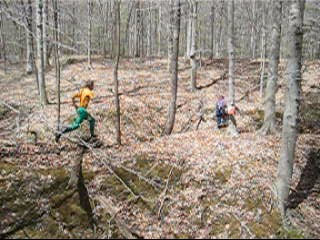
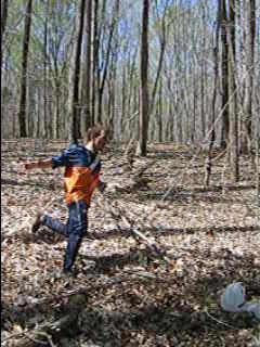
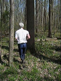
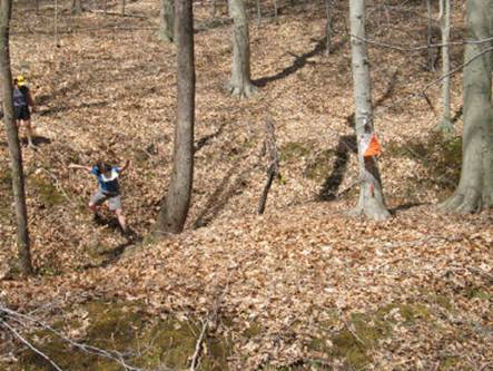
Video of Orienteering in Patuxent
|
|
|
|
|
Patuxent River Park/Merkle Natural Resource Management Area
Near
|
|
|
|
South
of the
Video of Orienteering in Patuxent
|
|
|
|
|
Getting There
From the Capital Beltway (I-495), take Pennsylvania Avenue, Rte. 4, east toward Upper Marlboro. Exit onto Crain Hwy, Rte. 301, south after 7.25 miles. Turn left at Croom Station Rd. in about 1 mile. Turn left again after 1.5 miles onto Croom Rd. Turn left again after 1.5 miles onto Croom Airport Rd. After 2 miles, make a final left turn onto the Park Entrance Rd. into Patuxent River Park. Follow the road 1.7 miles to the parking area just past the visitor center.
Area
Routes
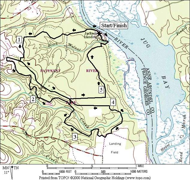
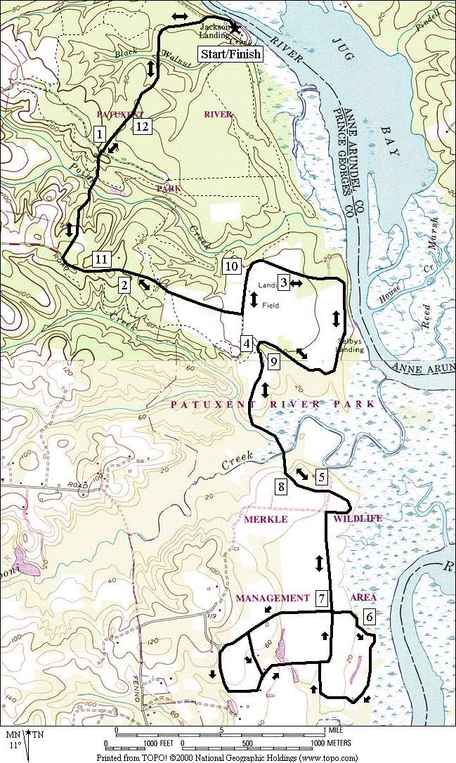
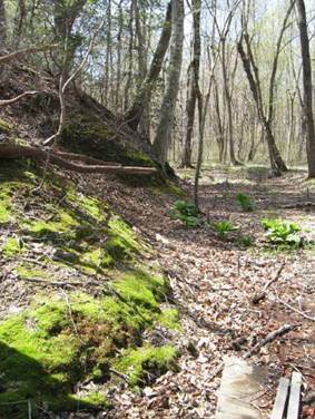
Navigating the trails in Patuxent River Park is easy...as long as you’re familiar with them! Until your familiar using the trails use caution and do not to test your distance endurance abilities. You may tire, confused in the middle of the large parks. There are few facilities and hardly any water stops. Since the trails are mostly in the woods you must be a good orienteer to find the recognizable natural or man-made landmarks that will reinforce you’re understanding of where you are at. At least one park superintendent has been against using blazes. The trails are marked occasionally. The trail blazes that do exist are often black horseshoes on wooden posts with arrows carved into them signify direction. Though there are official names for the trails, the names are not posted at trail heads or intersections. This might change. What you get for your troubles in the park however are long and soft trails through the woods, across streams and around gullies. Most are flattish but occasional sudden drops to creeks are followed by equally sudden short climbs. The lay of the land slopes gradually toward the Patuxent and Mataponi Creek. Mountain biking is allowed on all but the Black Walnut Nature area trails but as of 2006, comparatively few people use the park for cycling.
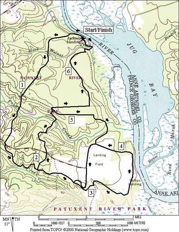
Half Pone (6.6 or 4.45 or 5.75 miles, VI, III or V)
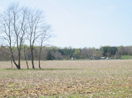
This route starts up the Park Entrance Road. The road is not indicative of most of the trails on the route. It’s hillier. Once you reach Croom Airport Rd., turn left and make an immediately right onto an unmarked trail that drops toward Old House Creek. At the bottom it sinews and rolls up and down a little. The first short option turns left on the Half Pone Trail, up a short hill to cross the Croom Airport Road and then go on to the Lone Pine and Chapman trails. Going straight at the intersection for the regular route, the trail you’re on becomes the Half Pone Trail. At an intersection with a dirt and gravel road, a second short option passes through the group camping area, and the old Croom Airport/Mataponi Creek area where the big Riverside field is. This short option uses the paved portion of the CBCAD for a short way to get to the trail head of an unnamed hiking trail where it joins the regular route again. The regular (middle distance) route gets to this point by continuing straight past the dirt and gravel road, staying in the woods longer before arriving at Riverside Field. It then goes around the large flat field by getting on the CBCAD and intersecting the unnamed hiking trail from the opposite direction that the second short option gets there from.
As the unnamed hiking trail goes into the woods, it drops to Swann Point Creek, crossing over on wooden and pipe bridges. An initial steep climb after crossing is followed by a gradual one all the way to the Lonesome Pine cut-over trail. This is where the initial short option joins in. Turn right at the next intersection and onto the Chapman Trail to head back to the visitor center. If you keep a close watch, you can follow signs from the intersection back to the visitor center parking by using the Pine Flat Trail, then passing through the Black Walnut Creek Nature Study Area.
Mt. Calvert (5.9, 3.3 or 4.1 miles, V, II or III)
Start
by going out the
Chesapeake Bay Critical Area Drive (12.85, 13.3, or 12.9 miles, X)
This
route stays on the road with few turns and so is easier to follow than the
other routes listed. It’s long however and
the few turns do lack signs. Unless your
going on Sunday,
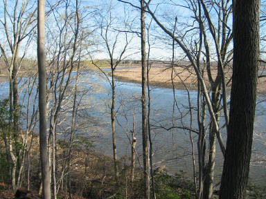
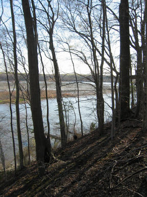
Next, bear right (through the gate if its closed and if you have your reservation) at Selby’s Landing, a popular parking area most used for launching motor boats and sometimes jet skis. Before the silting of the river from agriculture and destruction of the natural forests across the region by the mid-1800's, ocean going vessels launched from here. The first white visitor, John Smith of Virginia, sailed past here in 1608. The river still maintains depths in excess of 40 feet in areas nearby.
After passing Selby Landing the route continues around Riverside Field on the CBCAD. Upon leaving it, it soon drops to the nearly 1,000 foot long wooden bridge across Mataponi Creek, and enters the MNRMA. One observation tower is accessible in the middle of the bridge and another is located a short ways further on the other side. Most of the roads in the MNRMA are crushed gravel not different from that found on the C&O Canal. They are only slightly less flat. One options stays near the river, passing the Osprey nesting area before looping back. The others loop uphill away from the river toward the MNRMA Visitor Center, and return past the windmill at Windmill Pond. After any of the loops, return on the roads the way you came.
Nearby and Connecting Zones
What
to do Afterward
Food and Drink
Pizza Hut - off Rte. 301 at South Osborne Rd.
picnic
Entertainment
and Edification
Merkle Natural Resource Management Area Visitor Center - 301 888-1410, TTY 410 974‑3683
Distance: 6.6 or 4.45 or 5.75 miles
Rating: VI, III or V; mostly single-track trails through the woods
6.6 Mile Route
0.0 from parking, head past the visitor center toward the park exit
0.15 gravel road on R
0.4 Mt. Calvert Trail on R
1.05 Chapman Trail
1.1 Lonesome Pine Trail
L 1.6 Croom Airport Rd. at T
R 1.65 trail X on R (unmarked)
BL 1.85 trail X at bottom of hill
<*
2.15 unmarked Half Pone Tr is S & on L
2.4 trail X on L (unmarked)
<**
2.65 gravel/dirt road
2.75 trail X on L cuts to gravel/dirt road
R 3.05 follow grassy trail S to, then R along woods at the edge of Riverside Field
L 3.1 CBCAD road (unmarked, fence)
3.35 trail X on R
3.65 merge onto road at gate (Selby’s Landing parking; portable outhouse)
3.9 gravel road on R
4.1 Aviation History sign
R 4.25 trail X on R (unmarked)
>**
4.4 Swann Point Creek bridges
5.15 trail X on L to Lonesome Pine Tr
>*
R 5.2 Chapman Trail (unmarked)
L 5.65 trail X on L to visitor center
L 6.25 trail X on L to visitor center; (! stairs)
R 6.3 at T; Black Walnut Cr Nature Study
L 6.45 trail X on L on boardwalk
R/L 6.5 at fence and to Park Entrance Rd.
6.6 visitor center parking circle
![]()
*4.45 Mile Route
L 2.15 unmarked Half Pone Tr is S & on L
2.35 Croom Airport Rd. (unmarked)
L 2.7 Lonesome Pine Trail (unmarked)
2.85 wooden bridge over Swann Pt Cr
BR 2.95 at trail X on L (Lonesome Pine Trail goes L)
L 3.0 at T (unmarked) (pickup cues at mile 5.9 on 6.6 mile route)
![]()
**5.75 Mile Route
L 2.65 gravel/dirt road (outhouses at 2.8)
2.75 trail X on R cuts to Half Pone Trail
2.85 barn/Riverside Field on R
3.0 Croom Airport Rd. on L & gates
3.35 Lonesome Pine Tr on L (unmarked)
L 3.4 trail X (unmarked) (pickup cues at mile 5.15 on 6.6 mile route)
Distance: 5.9 or 3.3 or 4.1 miles
Rating: V or II or III; mostly single-track unpaved trails through woods; small hills
5.9 Mile Route
0.0 from parking, head past the visitor center toward the park exit
0.15 gravel road on R
R 0.4 Mt. Calvert Trail on R
0.7 trail X on R
0.9 trail X on R
BL 0.95 as trail enters field
BL 1.2 at trail X
<*
R 1.2 at T; Chapman Trail (unmarked double-track)
L 1.4 Lonesome Pine Tr on L (unmarked)
2.25 Park Entrance Rd. (unmarked)
<**
BR 2.6 at trail X to stay on Lonesome Pine Trail
2.7 wooden bridge over creek
BL 2.9 Half Pone Trail on R (unmarked); go through gate ahead; closed Nov 1BMar 14
3.2 short steep downhill to wetland area
3.3 wooden bridge near beaver pond
L 3.45 CB Critical Area Drive (unmarked)
L 3.55 trail X (unmarked)
3.7 Swann Point Creek bridges
4.45 trail X on L to Lonesome Pine Tr
>**
R 4.5 Chapman Trail (unmarked)
>*
L 4.95 trail X on L to visitor center
L 5.55 trail X on L to visitor center; (! stairs)
R 5.65 at T; Black Walnut Cr Nature Study
L 5.75 trail X on L on boardwalk
R/L 5.8 at fence and to Park Entrance Rd.
5.9 visitor center parking circle
![]()
*3.3 Mile Route
L 1.2 Chapman Trail at T (unmarked double-track)
1.6 Park Entrance Rd. (unmarked)
L 1.9 at trail X on L; to stay on Chapman Trail (unmarked) (pickup cues at mile 4.5 on 5.9 mile route)
![]()
**4.1 Mile Route
L 2.6 trail X (unmarked)
L 2.65 at T (unmarked) (pickup cues at mile 4.5 on 5.9 mile route)
Chesapeake
Bay Critical Area Drive (CBCAD)
Distance: 12.85 or 13.3 or 12.9 miles
Rating: X; rural paved and gravel roads; some hills early and near the end
12.85 Mile Route
0.0 from parking head past the visitor center
toward the park exit
0.4 Mt. Calvert Trail on R
1.05 Chapman Trail
1.1 Lonesome Pine Trail
L 1.6 Croom Airport Rd. at T
1.65 trail X on R (unmarked)
1.75 gate on R (abandoned trail)
2.05 Half Pone Trail (unmarked)
2.15 trail X on R (unmarked)
L 2.5 at T in front of Riverside Field; go
through gate to start CBCAD
2.85 Lonesome Pine Tr on L (unmarked)
2.9 trail X (unmarked)
3.05 Aviation History sign
3.25 gravel Rd. on L to Half Pone Landing
BR 3.5 through gate at parking for Selby’s Landing
(portable outhouse)
3.75 trail X on L (unmarked)
4.0 trail X on R after Bluebird sign
4.5 begin wood bridge; Mataponi Creek
4.65 end wood bridge; enter Merkle Natural
Resource Management Area
5.2 trail X on L to observation tower
5.35 gate to gravel road on R
<*
5.8 gravel road on R for return route; begin
Osprey Nesting area
6.2 trail X on L to boardwalk
6.75 gravel road bears R at X
>*
R/L 7.0 to gravel road on R to return
7.5 gate to gravel road on L
7.65 trail X on R to observation tower
8.2 begin wood bridge; Mataponi Creek
8.35 end wood bridge; Patuxent River Park
8.85 trail X on L before Bluebird sign
9.1 trail X on R (unmarked)
9.35 merge roads at gate/parking for Selby’s
Landing (portable outhouse)
9.6 gravel Rd. on L to Half Pone Landing
9.8 Aviation History sign
9.95 trail X (unmarked)
10.0 Lonesome Pine Tr on L (unmarked)
R 10.35 Croom Airport Rd. (unmarked)
10.7 trail X on L (unmarked)
10.8 Half Pone Trail (unmarked)
11.1 gate on L (abandoned trail)
11.2 trail X on L (unmarked)
R 11.25 Park Entrance Rd.
11.75 Lonesome Pine Trail (unmarked)
11.8 Chapman Trail (unmarked)
12.45 Mt. Calvert Trail on L (unmarked)
12.85 visitor center parking circle
![]()
*13.3 Mile Route
R 5.8 gravel road on R to second gravel road;
before Osprey Nesting area
6.25 gravel road on L
<**
6.25 merge onto paved road
L 6.4 Rd. X; to visitor center
6.65 Paw Paw Trail on R (yellow blaze)
6.8 Merkle Visitor Center (water/restrooms)
R 6.85 gravel road on R before red shed
>**
6.95 windmill on L; wildlife ponds ahead
7.15 merge with gravel road on R (pickup cues at
mile 7.0 on 12.85 mile route)
![]()
**13.35 Mile Route
L 6.25 paved road on L toward visitor center
L 6.5 gravel road on L after red shed (pickup
cues at mile 6.95 on 13.3 mile route)