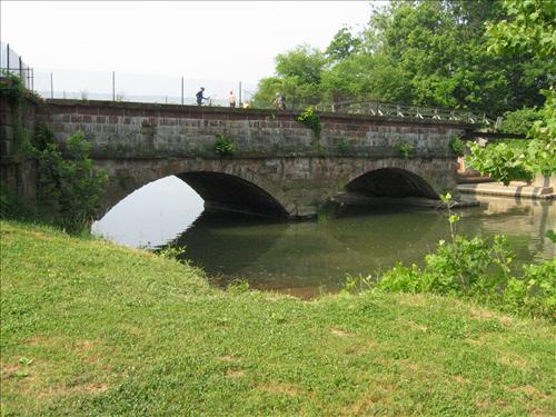
C&O Canal, Riley’s Lock
Riley’s
Lock, Lock 24, is at the mouth of the Great Seneca Creek, eight and one-half
miles above Great Falls, Maryland. In its heyday the area was a hub of
commercial of activity. The C&O
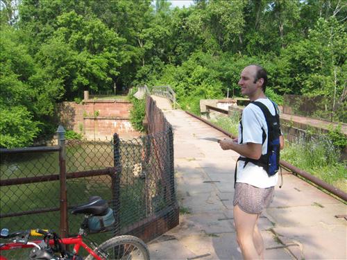
Canal passed over the Great Seneca Creek via an aqueduct here. Now, a foot bridge takes traveler’s across
but the old stone works are still visible along with the original stone cutter’s
initials carve into the stone. The
cutters were paid by the rock for each massive block. Their initials represented a form of payment
invoice. To the southeast, the canal
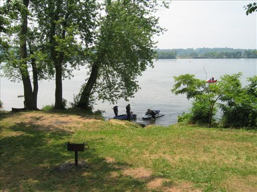
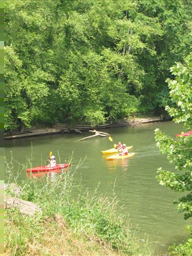
towpath is along beautiful stretches of the Potomac River
shores. Rapids demonstrate the power of
the water. To the northeast, the towpath
is largely surrounded by trees but offers occasional views of river islands. Due north from the lock, the Greenway Trail,
mostly designed as a hiking trail, can be followed approximately 14 miles to
the Visitor Center at Lake Clopper in Gaithersburg.
Getting
There
Take
the Capital Beltway (I-495), to the River Road (Rte. 190) headed west, outside
the beltway. After 11.5 miles, turn left
at a T-intersection to stay on River Rd.
At the bottom of the hill, in 0.7 miles, turn left onto Riley’s Lock
Rd. Park
another 0.7 miles later just before the canal and river. Riley=s
Lock and the towpath are up the stairs directly ahead.
Area
Routes
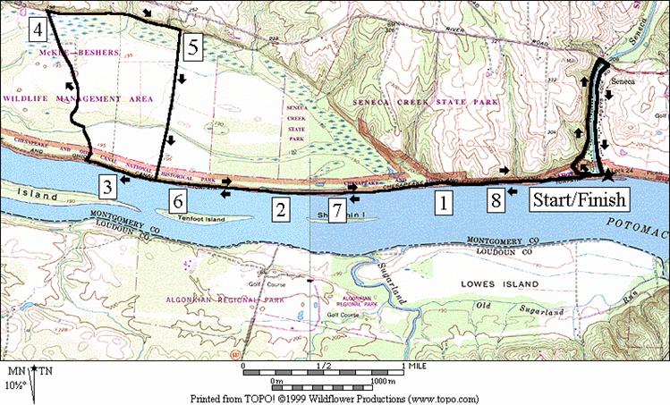
McKee-Beshers
Wildlife Management Area (8.65 or 10.1 miles, VI or VIII)
The
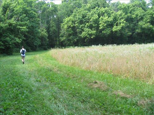
McKee-Beshers Wildlife Management Area (WMA) is mostly a flood plane of the Potomac
River. Within it are some
farmed fields, aquatic ponds, and scattered deer. It’s run by the state of Maryland
and is hunted in during fall months. The
flat and mostly open land has some dirt roads through it which are good for
running on. The roads can however be
muddy with large impassable puddles in wet seasons. To get there from Riley’s Lock, follow the
towpath northwest. After an initial pond
on the right, the canal northward is mostly a muddy ditch or completely
dry. The towpath can be very muddy after
rains too. Algonkian
Park in Virginia
is visible briefly, across the river on the left. Three miles up, just after mile 26 of the
towpath is the Horsepen Branch campground.
A sign, a small clearing, a water pump (this water should be treated
before drinking from it) and portable outhouse are the only amenities to
identify it. At the pump, a dirt trail
on the right side of the towpath crosses the dry canal bed into the WMA. The trail leads to a double-track road. Bear left on it going straight at other intersections. The road becomes bigger and better defined
before passing large ponds on the left and right. After a gate at a T-intersection, turn right
on the unmarked Hunting Quarter road.
This road is unpaved also but does get occasional auto traffic. After crossing a creek, turn right at the
first parking area and follow the dirt road back toward the river. The dirt road becomes less and less defined
as you near the woods but a dirt trail at the end of it does go through the
woods to the towpath. Turn left on the
towpath and return to Riley’s Lock for the regular route.
For
an optional extension, turn left just before reaching Riley’s Lock, and after
the pond on the left. It leads to other
dirt trails but take the unmarked gravel road up to River
Road. There
watch for the fast moving traffic, then cross the Great Seneca Creek to Riley’s
Lock Rd. immediately on the other side.
Jeb Stuart crossed the creek near this same location in 1863. Finish on Riley’s Lock
Rd. which leads back to the parking area.
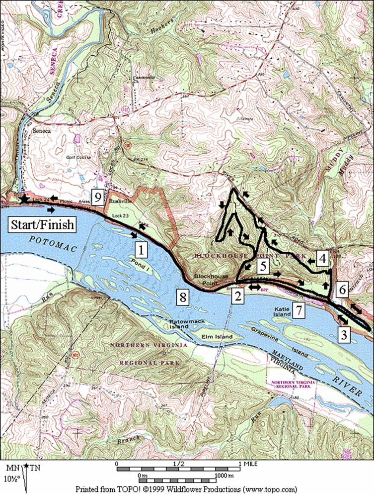
Blockhouse Point Conservation Park,
Western Approach (9.55 or 11.1 miles; IX or X)
Getting
to Blockhouse Point
Conservation Park
from Riley’s Lock is an excellent way to see the wilder side of the Potomac
River up-close. Using the
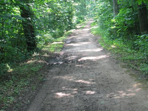
towpath the canal is at first dry. After
Violet’s Lock, Lock 23, an intake from the river suddenly fills it. Also at Violet’s Lock where Blockhouse Point
begins, the river gets narrower and swifter.
Blockhouse Point is a rocky mound of earth that juts into and squeezes
the river. The water rolls and twists
in rapids over the rocky bottom, with the entire river dropping 10 feet in one
and a quarter miles. At the point, the
towpath becomes a narrow ribbon of land behind a concrete retaining wall, with
the river on the right, and the canal and cliffs on the left. You must pass Blockhouse
Point Conservation
Park in order to cross the canal at
Pennyfield Lock (Lock 22), double-back and enter it from the east. See
Blockhouse Point
Conservation Park,
Southern Approach for a description of the regular route within the park. The dirt trails on the optional extension are
less used, more difficult to traverse and more difficult to navigate than those
on the regular route. They take you to
the fenced western border of the park.
There, the stark difference between cattle grazed and badly eroded land
contrasts sharply with beautiful tall trees, ferns and other undergrowth inside
the park. Though the trail getting to
the western border is relatively flat, the return is over some short but steep
up and down hills. Return back to Riley’s
Lock via the bridge at Lock 22 and the towpath.
Nearby
and Connecting Zones
C&O Canal, Great Falls, Maryland
C&O Canal, Edwards Ferry
Seneca State Park, Blacks Mill
Seneca State Park, Schaeffer Farm
What
to do Afterward
Food
and Drink
picnic
Entertainment
and Edification
Seneca
Schoolhouse Museum,
circa 1868 - off River Road, west
of Riley’s Lock Road
Edwards
Ferry - old mill factory remains
Whites
Ferry - an operational ferry over quiet waters of the Potomac takes people to
Leesburg - 301 349-5200
R 0.0 from
the bridge over Riley’s Lock (Lock 24)
0.05 trail
X on R crosses canal shortly after crossing the Great Seneca Creek
0.2 mile
mark 23; pond on R
1.15 mile
mark 24
2.15 mile
mark 25; Algonkian Park across river
2.8 trail
X on R (unmarked) into McKee-Beshers WMA
R 3.15 trail
X on R at Horsepen Branch camp; trail is near water pump; camp is after mile 26
BL 3.5 onto
double-track dirt road (unmarked); go straight at all intersections
R 4.05 Hunting
Quarter Rd at T after gate (unmarked gravel road)
4.55 creek
crossing
R 4.9 dirt
road at parking area (unmarked)
5.25 Rd
X
L 5.85 C&O
Towpath between towpath miles 25 & 26 (same as mile 2.8)
6.5 mile
mark 25; Algonkian Park across river
7.45 mile
mark 24
8.45 mile
mark 23; pond on L
*<
8.55 trail
X on L crosses canal ditch after pond on L
8.65 Riley’s
Lock (Lock 24)

*10.1
Mile Route
L 8.55 trail
X on L crosses canal ditch after pond on L
R 8.7 Tschiffely
Mill Rd (unmarked, gravel); mill remains on L
R 9.35 River
Rd crosses Great Seneca Cr (!)
R 9.4 Riley=s Lock Rd (Greenway Trailhead to
Clopper Lake is L 0.05 miles)
10.1 parking
for Riley’s Lock
Blockhouse Park, Western Approach
Distance: 9.55 or 11.1 miles
Rating: IX or X; flat shaded towpath and some
hills on unpaved trails in Blockhouse Park
9.55
Mile Route
L 0.0 from
the bridge over Riley’s Lock
0.65 Violet’s
Lock (Lock 23)
2.0 petroleum
pipeline
L 3.15 Pennyfield
Lock (Lock 22); follow the path past parking and onto Pennyfield
Lock Rd
S 3.45 into
parking as Pennyfield Lock Rd turns R up hill
L/R 3.5 to
canal & over Muddy Br Creek
3.6 trail
turns R and leaves canal
S 3.65 at
pumping station clearing go S to gravel road w/creek on R (note the concrete block
here to find the location of the trail on return)
L 3.85 trail
X on L; begin the hill
4.25 trail
bears L at wood fence
4.55 trail
X on L merges
<*
L 4.65 gravel
road in pipeline clearing; downhill; parking on R for alt Start
4.9 trail
X on R
>*
L 5.15 double
track road at T before canal
R 5.9 2nd
trail on R to return to canal (near pumping station and concrete block)
L/R 6.05 leave
canal for the road at parking
6.1 Pennyfield
Lock Rd joins from L
6.3 gate
at end of parking
R 6.4 onto
towpath at Lock 22, Pennyfield Lock
7.6 petroleum
pipeline
8.9 Violet’s
Lock (Lock 23)
9.55 Riley’s
(Lock 24)
*11.1
Mile Route
S 4.65 gravel
road X in pipeline clearing
L 5.1 trail
X on L (gate blocks horses) at western border of park
5.25 trail
X on L
BL 5.55 trail
X on R crosses stream; start steep uphill ahead
R 6.0 trail
X at T; steep downhill ahead
R 6.45 gravel
road at T in pipeline clearing (pickup cues at mile 5.15 on 9.55 mile route)