Capital Crescent
Trail (and the Georgetown Branch Trail)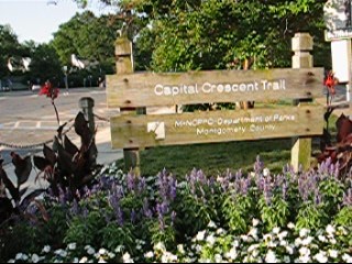 asphalt, mostly shaded, long graded hills |
Segment in Miles |
Cumulative Miles |
Miles Remaining |
| Trail head at Stewart St (near Silver Spring) | 0.00 | 11.03 | |
| driveway for used car dealer | 0.13 | 0.13 | 10.90 |
| underpass for Lyttonsville Pl | 0.11 | 0.24 | 10.79 |
| BL at Capital Crescent Trail split | 0.23 | 0.47 | 10.56 |
| BR on sidewalk | 0.06 | 0.53 | 10.50 |
| R on Terrace Dr | 0.08 | 0.61 | 10.42 |
| Parking for OHR Kodesh Congregation & Meadowbrook Park | 0.21 | 0.82 | 10.21 |
| R on Freyman Dr | 0.12 | 0.94 | 10.09 |
| R on Rock Creek Trail; East-West Hwy and Meadowbrook Ln | 0.05 | 0.99 | 10.04 |
| water fountain (closed in winter) | 0.11 | 1.10 | 9.93 |
| OHR Kodesh Congegation & Meadowbrook Park parking | 0.04 | 1.14 | 9.89 |
| RR bridge underpass | 0.21 | 1.35 | 9.68 |
| wooden bridge over Rock Creek | 0.20 | 1.55 | 9.48 |
| L at TR X (Crescent connector) | 0.04 | 1.59 | 9.44 |
| L at Susanna La (unmarked) | 0.15 | 1.74 | 9.29 |
| L at Jones Mill Rd | 0.17 | 1.91 | 9.12 |
| XS at Jones Bridge Rd | 0.02 | 1.93 | 9.10 |
| R onto trail | 0.03 | 1.96 | 9.07 |
| wooden bridge | 0.57 | 2.53 | 8.50 |
| L at Connecticutt Ave | 0.07 | 2.60 | 8.43 |
| R to cross Connecticutte Ave at Chevy Chase Lake Dr | 0.04 | 2.64 | 8.39 |
| R on sidewalk/trail | 0.02 | 2.66 | 8.37 |
| BL as paved TR goes into woods; pavement ends | 0.02 | 2.68 | 8.35 |
| East-West Hwy underpass | 0.71 | 3.39 | 7.64 |
| tunnel begins | 0.41 | 3.80 | 7.23 |
| TR X on L; to Elm St Park | 0.02 | 3.82 | 7.21 |
| tunnel ends | 0.19 | 4.01 | 7.02 |
| R/L at Bethesda Ave/Woodmont X to cross | 0.06 | 4.07 | 6.96 |
| L trail; before car dealer | 0.04 | 4.11 | 6.92 |
| TR X on L cut through to parking lot | 0.06 | 4.17 | 6.86 |
| Mile Marker 3.5 | 0.09 | 4.26 | 6.77 |
| TRX before bridge over Bradley | 0.05 | 4.31 | 6.72 |
| Little Falls Parkway (Bethesda Pool & Little Falls Trail on L | 0.39 | 4.70 | 6.33 |
| Mile Marker 4 | 0.05 | 4.75 | 6.28 |
| Bridge over creek | 0.04 | 4.79 | 6.24 |
| Dorset Ave | 0.24 | 5.03 | 6.00 |
| Bridge over creek | 0.12 | 5.15 | 5.88 |
| Mile Marker 4.5; start BR for River Rd | 0.10 | 5.25 | 5.78 |
| End Bridge for River Rd | 0.18 | 5.43 | 5.60 |
| TR X on L (unpaved) | 0.17 | 5.60 | 5.43 |
| plaque for Loughborough Mill (circa. 1830) | 0.13 | 5.73 | 5.30 |
| Mile Marker 5 | 0.02 | 5.75 | 5.28 |
| Bridge over Massachusetts Ave | 0.13 | 5.88 | 5.15 |
| TR X on L to Little Falls Trail | 0.03 | 5.91 | 5.12 |
| TR X on L & R w/Stairs; L is to Battery Bailey | 0.31 | 6.22 | 4.81 |
| Mile Marker 5.5 | 0.02 | 6.24 | 4.79 |
| TR X on R to Crossroads of the World | 0.12 | 6.36 | 4.67 |
| TR X to Little Falls Trail (paved on L, not on R) | 0.37 | 6.73 | 4.30 |
| Mile Marker 6 | 0.01 | 6.74 | 4.29 |
| Bridge over Little Falls Trail | 0.01 | 6.75 | 4.28 |
| TR X on R to Little Falls Trail (unpaved, uphill) | 0.08 | 6.83 | 4.20 |
| Metal heavy bridge; Dalecarlia on L | 0.06 | 6.89 | 4.14 |
| Tunnel under MacArthur begins | 0.07 | 6.96 | 4.07 |
| Tunnel under MacArthur ends | 0.07 | 7.03 | 4.00 |
| begin wooden bridge | 0.21 | 7.24 | 3.79 |
| end wooden bridge | 0.05 | 7.29 | 3.74 |
| Montgomery County/DC Line (sign) | 0.12 | 7.41 | 3.62 |
| TR X on R (unpaved) to Brookmont | 0.02 | 7.43 | 3.60 |
| TR X on L to Norton St and Potomac Ave | 0.06 | 7.49 | 3.54 |
| Mile Marker 7 | 0.24 | 7.73 | 3.30 |
| TR X on L to Potomac Ave | 0.14 | 7.87 | 3.16 |
| Mile Marker 7.5 | 0.36 | 8.23 | 2.80 |
| TR X on L to Potomac Ave & begin trestle bridge | 0.15 | 8.38 | 2.65 |
| trestle ends & TRX on R to C&O towpath | 0.08 | 8.46 | 2.57 |
| Mile Marker 8 at wood railings | 0.27 | 8.73 | 2.30 |
| nearest ramp to Fletcher's Boathouse | 0.20 | 8.93 | 2.10 |
| first ramp to Fletcher's Boathouse | 0.09 | 9.02 | 2.01 |
| Mile Marker 8.5 | 0.22 | 9.24 | 1.79 |
| Mile Marker 9 | 0.50 | 9.74 | 1.29 |
| TR X on L to C&O towpath | 0.16 | 9.90 | 1.13 |
| Mile Mark 9.5 | 0.33 | 10.23 | 0.80 |
| Glover Archbold Trail on L | 0.43 | 10.66 | 0.37 |
| Mile Marker 1 (10?) | 0.07 | 10.73 | 0.30 |
| poles mark trail end | 0.30 | 11.03 | 0.00 |
| Total | 11.03 | ||